Geology
Is Vesuvius Active? Its Last Eruption, Monitoring and the Red Zone
Yes. Vesuvius is an active volcano, but it has not erupted since March 1944. Since then it has been in what volcanologists call quiescence: the conduit that fed the last eruption is blocked, and the only outward signs of life are fumaroles and small earthquakes. The national park describes it as the only active volcano of continental Europe, and because about 700,000 people live at its foot, it is also one of the most closely watched volcanoes in the world.
On the Civil Protection Department’s page, checked on 30 September 2026, the alert level for Vesuvius is green, the lowest of four levels, meaning nothing anomalous compared with the volcano’s ordinary activity. For visitors that means the crater path runs under its normal rules. When it closes, it is for the weather, not for the volcano.
The short answer
- Is it active? Yes, but quiescent since 1944.
- Last eruption: it began at 16:30 on 18 March 1944 and the explosions stopped on 29 March.
- Alert level: green, the lowest of four (checked on 30 September 2026).
- Monitoring: 24 hours a day, by the Osservatorio Vesuviano, the Naples section of Italy’s national institute of geophysics and volcanology (INGV).
- Latest bulletin: in August 2026, 112 small earthquakes, the largest of magnitude 1.6, and no ground deformation from magma.
- The risk: the towns on its slopes. A national emergency plan covers a red zone of 25 municipalities.
When did Vesuvius last erupt? The 1944 eruption
The 1944 eruption is the last eruption of Vesuvius. It closed a long period of activity that had begun soon after the great eruption of 1631, and it happened in the middle of the Second World War, with Allied troops in Naples.
The observatory’s director, Giuseppe Imbò, watched and measured it from the observatory’s historic building on the mountain at 608 m, and did not leave even during the most violent phase. He divided it into four phases:
- Lava. The first phase began at 16:30 on 18 March 1944 with an explosion in the crater, followed by two lava flows. In the early hours of 21 March lava entered the towns of San Sebastiano and Massa. Allied troops had organised the evacuation of about 7,000 inhabitants shortly before, and in all about 10,000 people from San Sebastiano, Massa and Cercola had to leave their homes.
- Lava fountains. From 21 March Imbò recorded eight lava fountains, spectacular jets of molten rock above the crater.
- Explosions. Next came discrete explosions and an eruption column reported at the time as more than 5 km high. Recent modelling suggests it actually reached about 10 km, hidden by cloud; its ash settled as far as 400 km away.
- Ash and earthquakes. In the final phase, ash emissions and earthquakes gradually died away, and the explosions stopped on 29 March.
The heavy ash fall was the deadly part. The Civil Protection Department puts the death toll at 21, killed by collapsing roofs; the observatory’s account counts 23 victims of roof collapses during the explosive phase alone. San Sebastiano, Massa di Somma and Terzigno were almost completely destroyed.
On 7 April the crater was found to be completely blocked. That date marks the start of the closed-conduit period Vesuvius is still in today.
How often does Vesuvius erupt?
There is no timetable. The volcano’s history, as the observatory and the Civil Protection Department describe it, is a mix of long silences broken by violent eruptions and long stretches of frequent, smaller ones:
- Plinian eruptions, the largest kind, have happened at least four times. The most recent was the eruption of AD 79 that buried Pompeii and Herculaneum.
- After AD 79 the volcano had two important periods of rest, each ended by a high-energy sub-Plinian eruption: in 472 and in 1631.
- Between the big events, countless Strombolian and effusive eruptions gradually built up the Gran Cono and sent lava down its southern and western slopes.
- Since 1944 there have been none at all.
So the present quiet is not unusual in itself, and it tells you nothing about a date for the next eruption. The emergency plan is built around detecting the change when it comes, not predicting when that will be.
Three centuries of eruptions, 1631 to 1944
To understand why 1944 matters, go back to 1631. That eruption broke a rest of almost five centuries, and it was devastating: pyroclastic flows swept through the towns from Pollena to Torre Annunziata and killed more than 5,000 people.
After 1631 the volcano stayed restless for more than three hundred years. The Civil Protection Department describes eruptions as constant in that period, separated by rests of just a few years. The observatory divides the activity between 1631 and 1944 into 18 cycles, each of which ended with a more violent final eruption. The 1906 eruption was the most energetic of the twentieth century. It was during these centuries that the cone of Vesuvius took on the shape visitors climb today.
The Civil Protection Department sums up the long-term pattern: Vesuvius alternates between periods of activity with an open conduit, when small eruptions are frequent, and periods of rest with a blocked conduit, when magma can accumulate at depth. The rests have ended in very energetic eruptions. That is why eight decades of quiet are not, on their own, a reason to relax, and why the volcano is watched so closely.
A volcano inside a volcano: Somma-Vesuvius
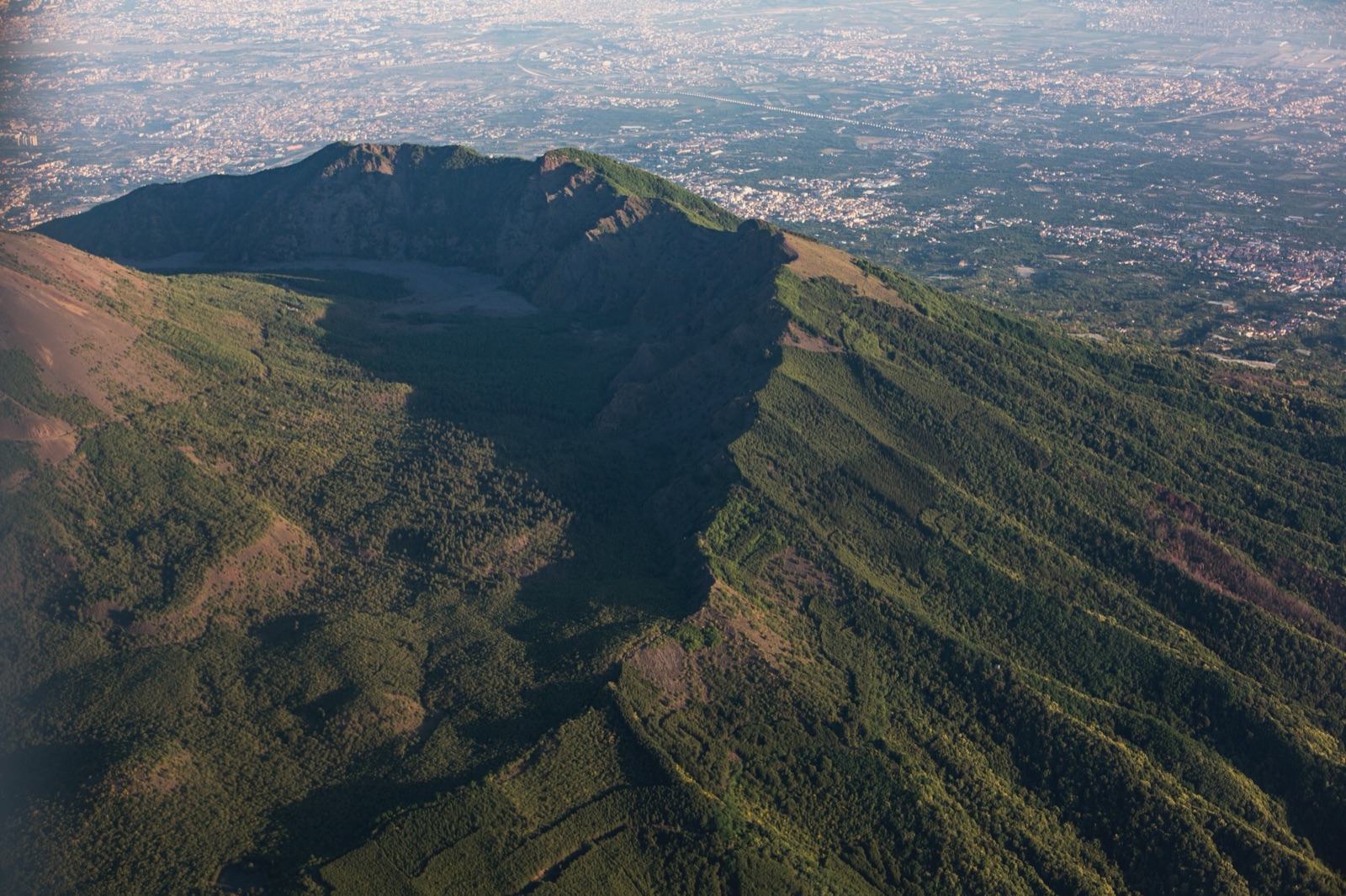
What people call Vesuvius is really two volcanoes, known together as the Somma-Vesuvius complex. The older one, Monte Somma, was largely destroyed by great explosive eruptions; its remaining rim is the ridge that curves around the north side of the mountain, reaching 1,132 m at Punta Nasone. The younger cone, the Gran Cono, grew inside Monte Somma’s caldera after the eruption of AD 79.
The national park gives these dimensions:
| Feature | Figure |
|---|---|
| Highest point of Vesuvius | 1,277 m |
| Crater diameter | 450 m |
| Crater depth | 300 m |
| Highest point of Monte Somma (Punta Nasone) | 1,132 m |
Between the two lies the Valle del Gigante, a valley covered by lava flows of the last few centuries, divided into the Valle dell’Inferno to the east and the Atrio del Cavallo to the west. Many of the historical lava flows, from 1631 up to the last eruption of 1944, came from vents at the foot of the crater and inside the Somma caldera.
Underneath, the observatory describes a deep magma reservoir between 10 and 20 km down. Before Plinian eruptions, the most violent kind, magma has collected in a shallow chamber at 3–5 km depth. The Civil Protection Department notes that geophysical surveys have not found a shallow chamber large enough to feed an eruption of that kind today.
What “quiescent” actually means
Quiescent is not the same as extinct. The observatory’s description of the present phase is precise: after 1944 Vesuvius entered a quiescence with a closed conduit, characterised by low seismicity and fumarole activity. The Civil Protection Department adds that since 1944 the volcano has produced only fumaroles and seismic swarms of moderate energy, with no ground deformation and no significant change in the physical and chemical parameters of the system, and that no precursor phenomena indicate a possible short-term resumption of eruptions.
You can see the fumaroles for yourself. The national park notes small fumaroles on the Gran Cono, a sign of its state of active rest.
How the Osservatorio Vesuviano watches it
Vesuvius is monitored 24 hours a day. The observatory combines several independent networks, because no single signal is enough to tell a real precursor from ordinary background noise:
- Earthquakes. The Vesuvius seismic network has 18 permanent stations, 6 of them also fitted with accelerometers, plus 6 transmitting stations of a mobile network. It detects both rock fracturing and signals linked to moving fluids or magma.
- Ground movement. A GNSS network measures ground movement continuously in three dimensions with millimetre precision, and tiltmeters pick up even smaller changes in slope.
- Heat and gas. Thermal imaging of the crater and regular geochemical sampling track the temperature and composition of the fumaroles.
The results are published as monthly bulletins, and the observatory’s website also shows seismic signals, earthquake locations and webcam images in real time. The summary for August 2026 shows what an ordinary month looks like: seismic activity stayed low, with 112 earthquakes recorded and a maximum magnitude of 1.6. Most of the located earthquakes were in the crater area, within the first kilometre of depth. Geodetic data showed no deformation attributable to magmatic sources; GNSS stations high on the cone even showed a slight subsidence, which the observatory puts down to gravity, compaction of loose surface material or local effects rather than to magma. The maximum temperature in the crater was stable, and geochemical data showed the multi-year decrease in hydrothermal activity in the crater area continuing.
The alert levels
Italy uses four alert levels for Vesuvius:
| Level | Meaning |
|---|---|
| Green | Base: the current condition |
| Yellow | Attention |
| Orange | Pre-alarm |
| Red | Alarm |
The levels are declared by the Civil Protection Department, in close coordination with the Campania Region and after consulting the national Major Risks Commission, on the basis of the data and hazard assessments from the observatory and the other scientific centres. Moving from one level to the next corresponds to changes in the monitored parameters, such as seismicity, ground deformation and the composition of fumarole gases. The four levels are meant to mark out the time before any renewed eruption, and the response scales up with them, culminating in the evacuation of the red zone.
At the time of writing Vesuvius is on green. Do not confuse it with the Campi Flegrei, the other volcanic area on the west side of Naples, which the observatory reports has moved to yellow. If you read about earthquakes around Naples, check which of the two volcanoes the report is about.
The red zone and the evacuation plan
Because so many people live around the volcano, Italy has a national emergency plan for Vesuvius. The key area is the red zone, defined in 2014, where evacuation before an eruption is the only way to protect people. It includes an area exposed to pyroclastic flows, the most dangerous phenomenon for people, and an area at high risk of roofs collapsing under ash and lapilli.
- Who is in it: 25 municipalities in the provinces of Naples and Salerno, among them Ercolano, Pompei, Portici, Torre del Greco and Torre Annunziata, plus parts of three Naples districts, Nola and an enclave of Pomigliano d’Arco.
- How many people: about 700,000 live at the foot of the volcano; the plan for moving out the red zone covers 670,000 residents.
- Where they would go: each red-zone municipality is twinned with an Italian region or autonomous province that would take in its evacuees.
- The yellow zone: 63 municipalities and three districts of Naples, exposed to heavy ash fall.
The plan works in stages. According to the Campania Region’s presentation, in the pre-alarm phase people in hospitals and care homes are evacuated. In the alarm phase, residents must leave the red zone within 72 hours of the alarm being declared.
Note that both Ercolano and Pompei are in the red zone, so the access to the crater and the ruins of Herculaneum and Pompeii all lie inside it. That is exactly why the monitoring and the alert system exist.
What the next eruption might look like
Nobody can say when Vesuvius will erupt again, but the emergency plan sets out what is most likely. According to the plan’s statistical studies:
- Violent Strombolian eruption (VEI 3): the most likely, at just over 70%.
- Sub-Plinian eruption (VEI 4), similar to 1631: just under 30%. This is the plan’s reference scenario: it has a fairly high probability, and the areas at risk from it also cover those at risk from the smaller Strombolian kind.
- Plinian eruption (VEI 5), like AD 79: the probability of the reference scenario being exceeded by one is only 1%.
The reference scenario involves a sustained eruption column several kilometres high, volcanic bombs and blocks falling around the crater, ash and lapilli falling tens of kilometres away, and pyroclastic flows running several kilometres down the slopes. The plan also admits a hard limit: if the volcano showed signs of reactivating, it would not be possible to tell from the precursors what type of eruption was coming. For how the AD 79 eruption unfolded, see our article on the Vesuvius eruption of AD 79.
What it means for visiting the crater
For a visitor, the practical answer is simple. With the alert level at green, the crater path runs under its normal rules: timed tickets bought online, entry in small groups and seasonal opening hours. When the path closes, it is because of weather alerts, which our guide to crater tickets and the Gran Cono path explains along with the refund rules.
A few things are worth knowing:
- You are walking on the young cone. The path climbs the Gran Cono and follows part of the rim of a crater 450 m across and 300 m deep.
- Look for the fumaroles. The small fumaroles on the cone are the most visible sign that the volcano is quiet, not dead.
- Look across to Monte Somma. The ridge to the north is the rim of the older volcano, with the Valle del Gigante and its lava flows between the two.
- Check the alert level before a trip if you want reassurance. It is published by the Civil Protection Department and on the observatory’s website, with the latest monthly bulletin.
If you would rather not organise the ticket and transport yourself, a crater ticket with a smartphone audio guide or a minibus from Pompeii with the park ticket included handles the logistics. Our guide on how to get to Vesuvius covers buses, shuttles and driving.
Frequently asked questions
Is Vesuvius still active?
Yes. It is an active volcano in a quiescent phase, with a blocked conduit, fumaroles and low-level earthquakes. It has not erupted since 1944, and the alert level is green, the lowest of four.
When was the last eruption of Vesuvius?
In March 1944. It began at 16:30 on 18 March, sent lava into San Sebastiano and Massa, and ended with explosions that stopped on 29 March. By 7 April the crater was blocked, which began the current quiet period.
Is it safe to visit Vesuvius?
Visiting the crater is routine while the alert level is green, and the volcano is monitored 24 hours a day. The path does close in bad weather, and the climb is not suited to everyone, so check the ticket rules and the forecast before you go.
What is the red zone around Vesuvius?
It is the area where evacuation before an eruption is the only way to keep people safe: 25 municipalities in the provinces of Naples and Salerno, including Ercolano and Pompei. In the alarm phase, residents must leave it within 72 hours.
Could Vesuvius erupt without warning?
The plan assumes that renewed activity would show up first in the monitoring, which is why there are four alert levels with steps that begin well before an eruption. What the precursors could not tell in advance, the plan admits, is what type of eruption was coming.
Is Vesuvius the only active volcano on mainland Europe?
The national park describes it as the only active volcano of continental Europe. The Campi Flegrei, a volcanic area rather than a single mountain on the other side of Naples, is also active and is currently on yellow alert.